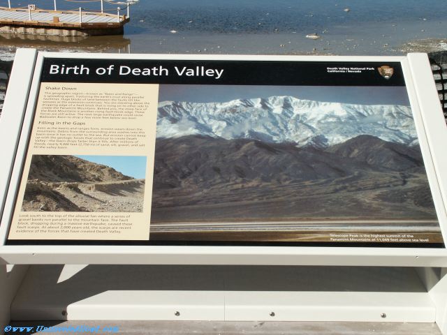
Birth of Death Valley
Shake Down
This geographic region -- known as "Basin and Range" --
is spreading apart, fracturing the earth's crust along parallel
faultlines. Huge blocks of land between the faults tilt like
seesaws as the extension continues. You are standing above the
dropping edge of a fault block that is rising on its other side to
create the Panamint Mountains. Behind you, the steep face of
the Black Mountains is another rising fault block edge. These
forces are still active. The next large earthquake could cause
Badwater Basin to drop a few more feet below sea level.
Filling in the Gaps
Even as the basins and ranges form, erosion wears down the
mountains. Debris from the surrounding area washes into this
basin since it has no outlet to the sea. But erosion cannot keep
up with the geologic forces that continue to create Death
Valley -- the basin drops faster than it fills. After millions of
floods, nearly 9,000 feet (2,750 m) of sand, silt, gravel, and salt
fill the valley basin.
Look south to the top of the alluvial fan where a series of
gravel banks run parallel to the mountain face. The fault
block, dropping during a massive earthquake, caused these
fault scarps. At about 2,000 years old, the scarps are recent
evidence of the forces that have created Death Valley.
Telescope Peak is the highest summit of the
Panamint Mountains at 11,049 feet above sea level.